Stratonikeia
An ancient city with a village still living inside it. It is the only site where you can sit your group down for tea in the middle of the ruins, and that changes what a visit here is for.
- Location
- Yatağan, Muğla
- Type
- Ancient city
- Typical visit
- 1 h 30 min
- Coordinates
- 37.3126, 28.0656
Summarize with AI:ChatGPTClaudePerplexityGrokGoogle AI Mode
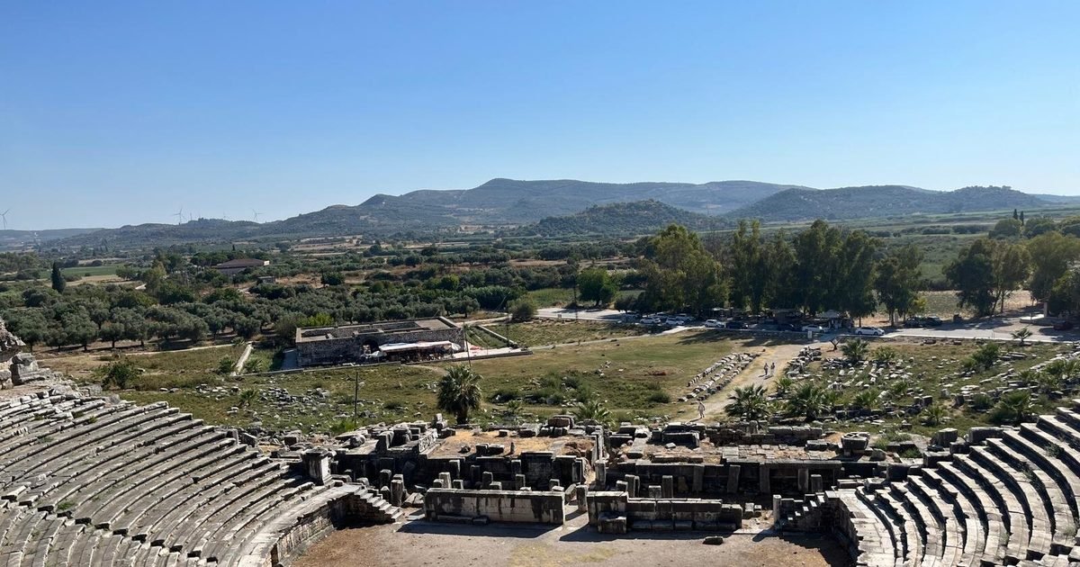
Stratonikeia was a Carian city, later Roman, and the village of Eskihisar grew up inside it and never left. Ottoman houses, a mosque and a café stand among the ancient street, the gymnasium and the theatre, on the same ground and often against the same walls.
Excavation continues through the year, so on most days there is work visible somewhere on the site.
The layering is the content
On most sites you explain one period and then leave. Here two are in the same frame: a marble column drum used as a garden edge, a plane tree growing where a colonnade ran, a wooden porch built against Roman masonry.
That is easier to show than to say. Walk the group to where the two things touch and let the picture do the work; the point lands faster there than in any amount of chronology.
A site with a café in the middle of it
There is a village square with tables under a plane tree, in the middle of the archaeological site. That is not a distraction to be managed -- it is the one place on a Carian day where a group can sit in shade, at the same table, and hear you without effort.
Use it deliberately. Do the walking first while people are fresh, then bring the group to the square and do the synthesis sitting down. Very few sites offer that and it is worth planning the visit around.
Practical notes
- The site is flat and compact; walking is easy.
- The village of Eskihisar is inside the site, with a café in the square.
- Excavation runs through the year, so there is usually work to see.
- Individual monuments are not separately mapped here, so the route is best set on the ground.
- Stratonikeia is not UNESCO-inscribed; it has been on Turkey's tentative list since 2015.

37.3126, 28.0656
Coordinates are for orientation, not for navigation.
Map data © OpenStreetMap contributors.
Notes for guides
What a guide needs to know before standing in front of a group here. Written from our own field work; where we have not verified something, it is not listed.
- RouteWalk first, sit last. The village square is the one place on a Carian day where the group can gather in shade and hear you without effort -- save the synthesis for it.
- TipShow the layering rather than explaining it: a column drum used as a garden edge says more than a chronology does.
- CrowdsQuiet, and the village is a working one. Keep the group off private thresholds and out of the way of anyone who actually lives there.
- TimingNinety minutes. The site is flat, so the limit is attention rather than distance.
- Being heardOpen ground with trees. Nothing reflects, so the constraint is distance to the back of the group; under the plane tree the group is close enough that it stops mattering.
Photographs
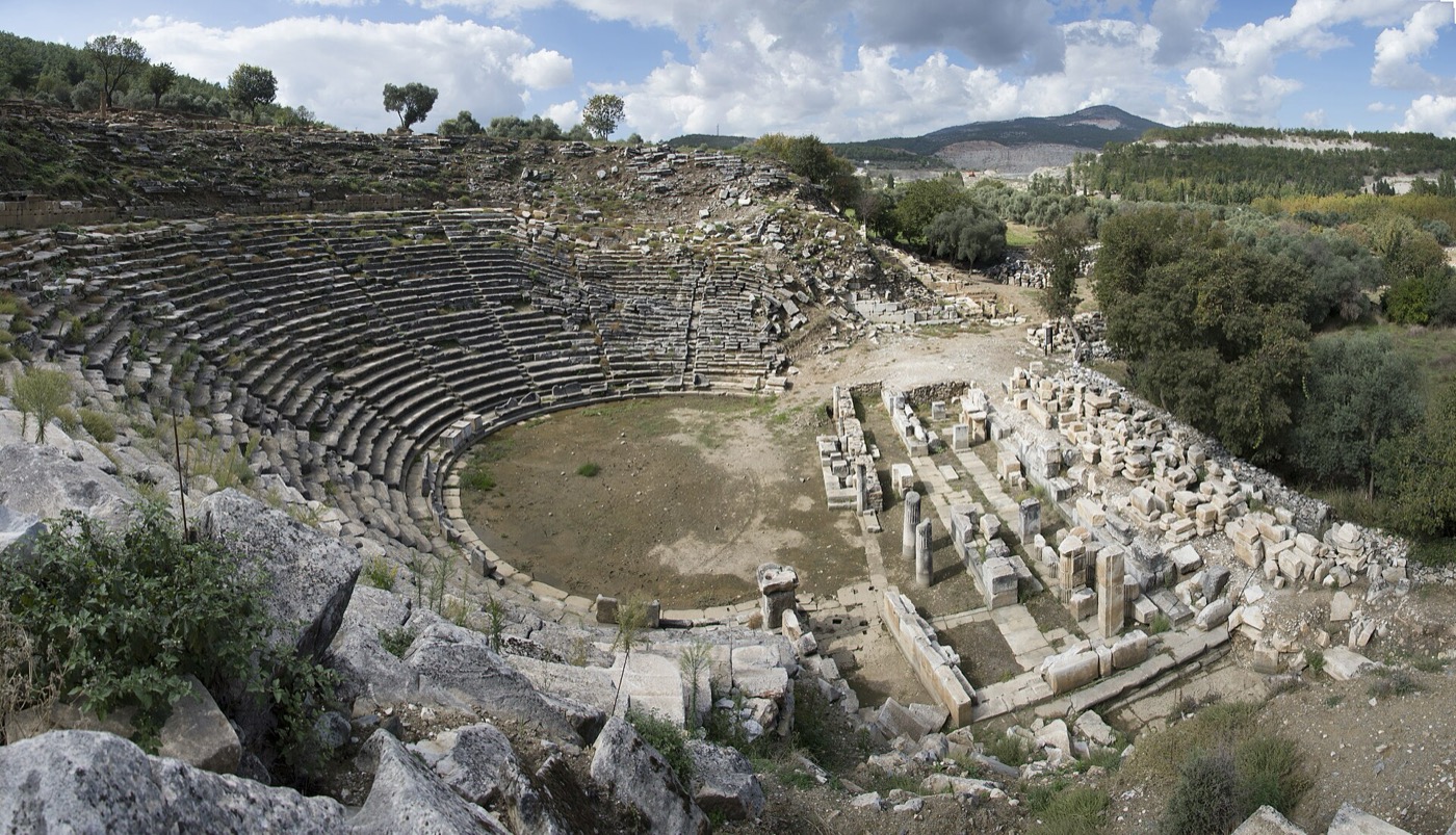
Photo: Dosseman (CC BY-SA 4.0)
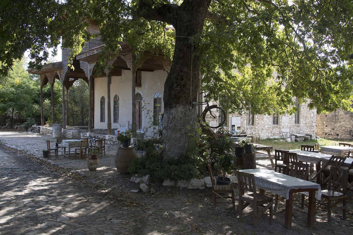
Photo: Dosseman (CC BY-SA 4.0)


Common questions
- How long does a group need at Stratonikeia?
- About ninety minutes. The site is flat and compact, so the limit is attention rather than walking.
- What makes Stratonikeia different from other ancient cities?
- A village still lives inside it. Ottoman houses, a mosque and a café stand among the ancient street and the gymnasium, so two periods are visible in the same frame.
- Can a group stop for tea at Stratonikeia?
- Yes -- there is a café in the village square in the middle of the site. It is the one place on a Carian day where a group can sit in shade and hear you without effort.
- Is Stratonikeia a UNESCO World Heritage Site?
- No. It has been on Turkey's tentative list since 2015 but has not been inscribed.
Related articles
Sources
Facts on this page come from the sources below. Photographs are credited individually.